We catch the 11 bus from Liskeard to Wadebridge. I don’t say much about our local town Liskeard but when you look around it is quite a handsome place with a lot of good quality buildings. You can see from the sky why we decided to go to the seaside…..
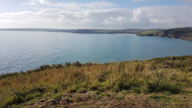
 From Wadebridge we catch a cute little local bus to Polzeath (pronounced Polzerth). We decided as we were in no hurry to have a good look around the beach there, so we walked towards the headland and returned via the houses – magnificent views and very expensive.
 Good surfing conditions and a few were out….
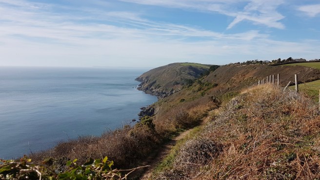
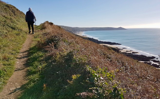
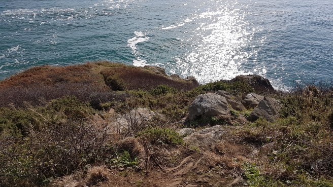
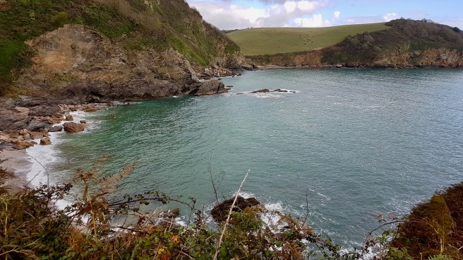
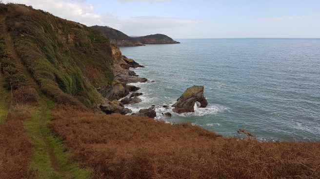
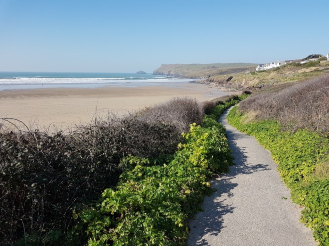 But it was time for our walk now, so we joined the South West Coast Path towards Rock.
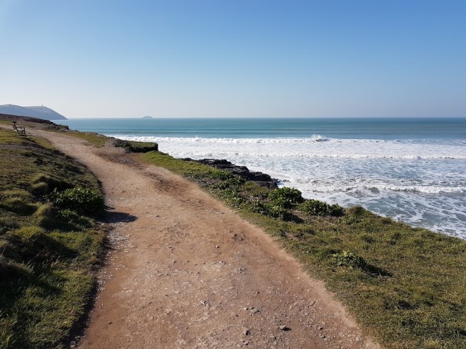 looking back now and again and……
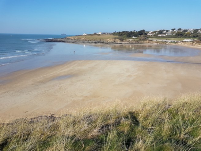
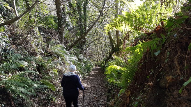
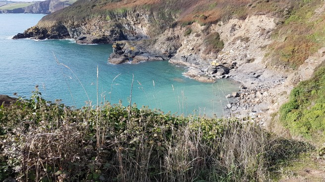
 …..with the occasional stop for a drink (it was warm when you escaped the wind). Along the way there are many smaller beaches with easy ways down….
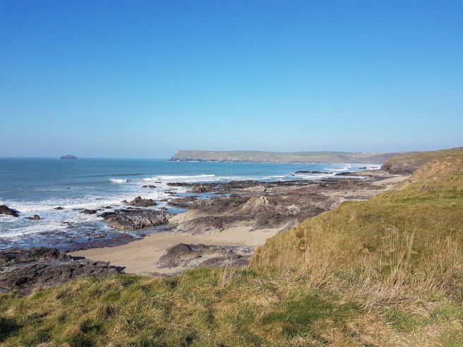 I do like ‘Private’ signs. they encourage a more radical me…one who wants all land (as in Scotland) to be free access.
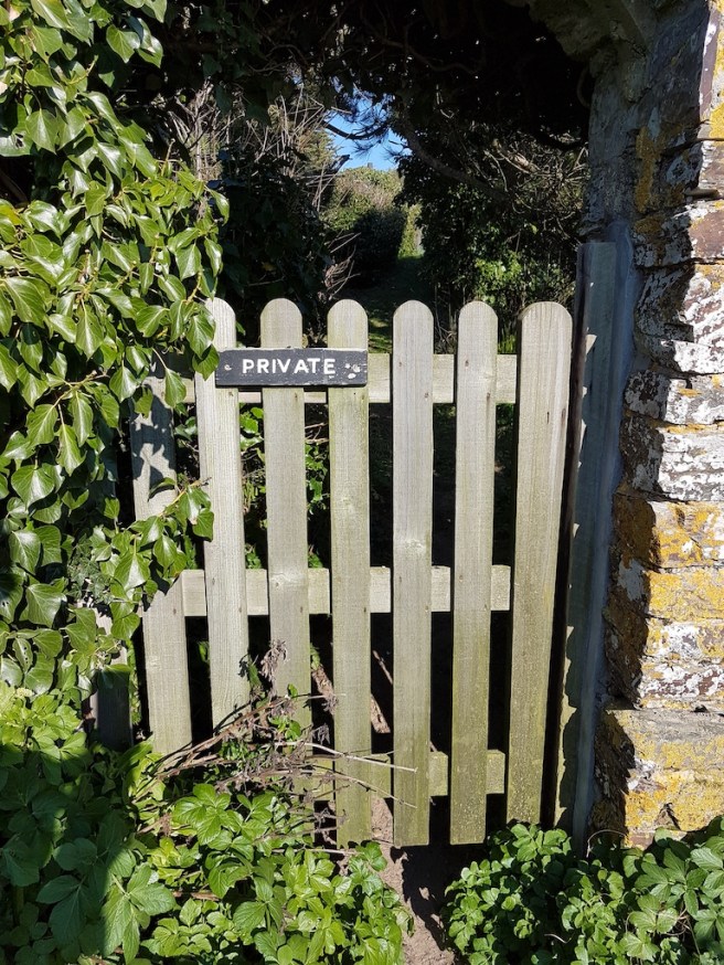 Looking ahead this is Daymer beach…..
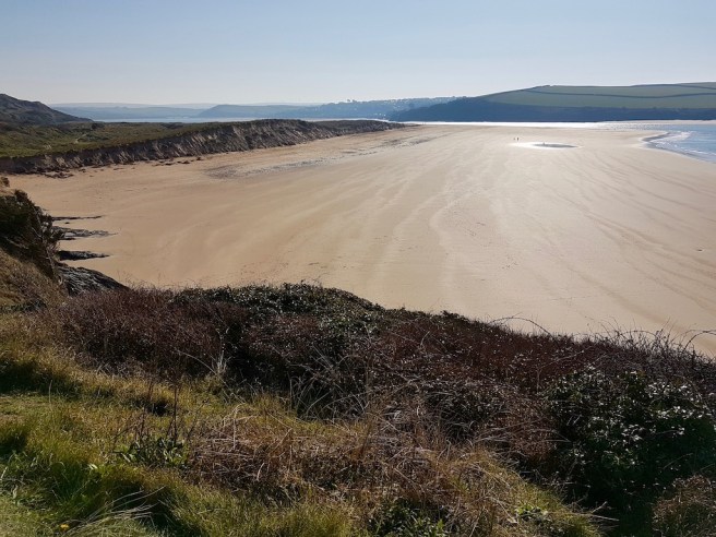 We walked through the magnificent dunes…
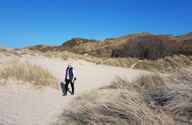 and of course what better at the end of a walk than a bit of light refreshment?
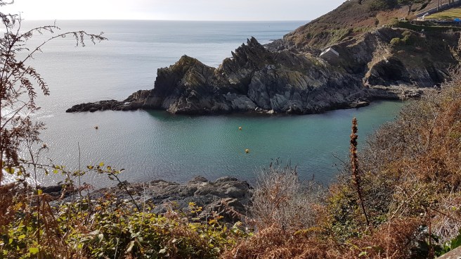
 Rather than walk up a steep hill through the residential road of exclusive Rock we took the ferry across to Padstow. Talking to the ferryman, when he closes at 4pm now but 6pm I think in Summer, there is a water taxi service should you wish to dine at one side or the other of the estuary and get back.
 I thought the wellington dog was good….
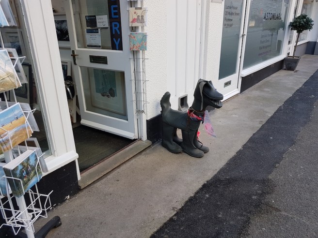 One of the trawlers in Padstow harbour seemed particularly colourful……
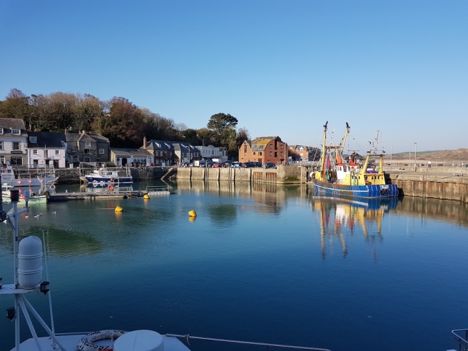 and all was still……..time for the bus home.
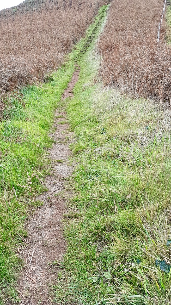
South West Coast Path
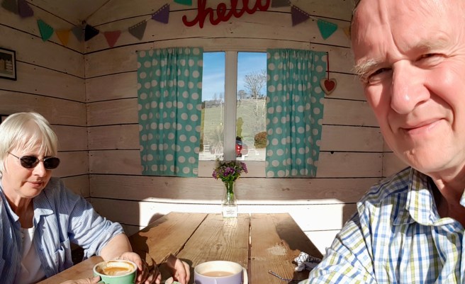
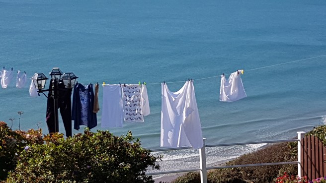
Our own beach hut…for 10 minutes anyway….
 After a quick trip to the doctors, warmth and blue skies beckoned us to the seaside, so off we went on our local 73 bus to Talland Bay for a walk to Looe. The start was downhill from the bus stop through a tunnel of green and brown to the shore.
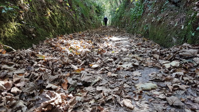
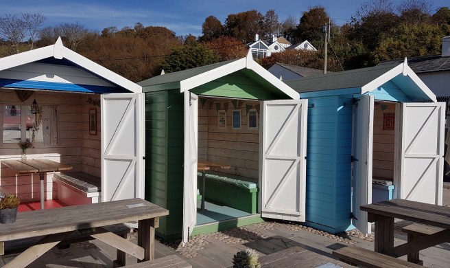
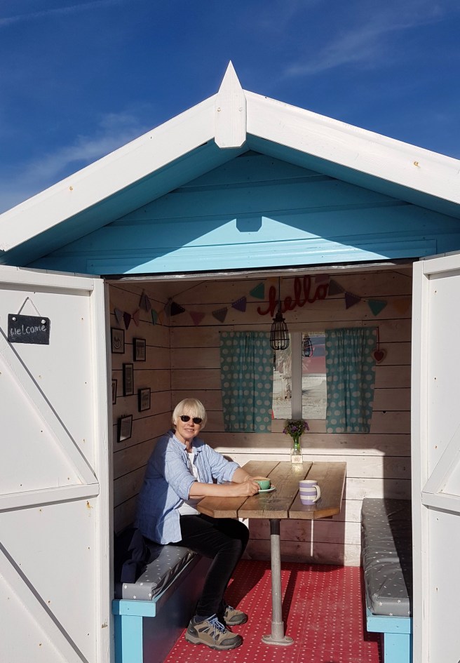
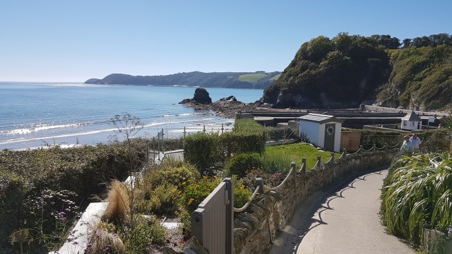
 When we arrived at the beach we saw that the cafe there, which we have never seen open before, was indeed doing business. After ordering our coffee and tea we decided to make use of their wonderful little beach huts. What a great idea of theirs and how sympathetic to the setting. A pleasant 10 minutes was spent admiring the view.
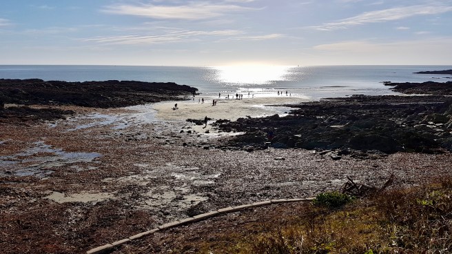
 That set us up nicely for the very steep climb up coronary hill…
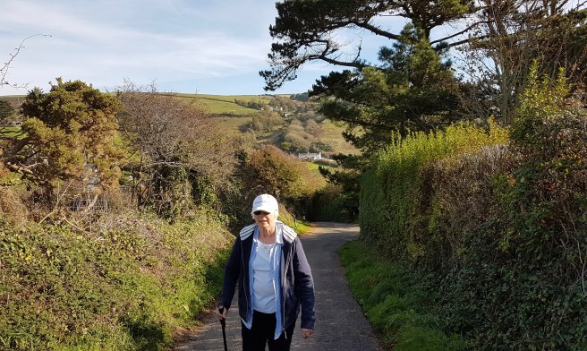
 and luckily someone who had obviously enjoyed this walk in the past had dedicated a seat just before the top…
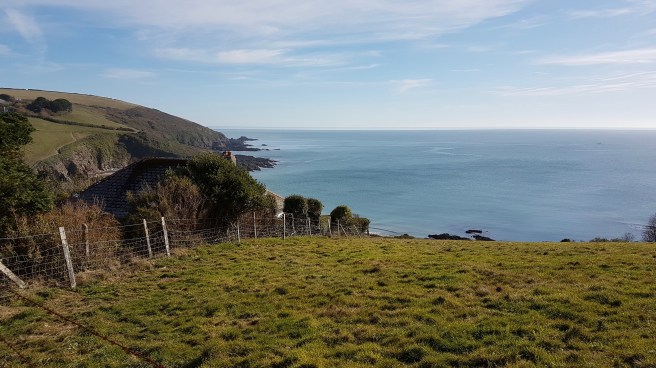
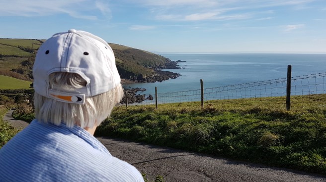 From now on a walk along how the Coastal Path should be – with stunning views and scenery….
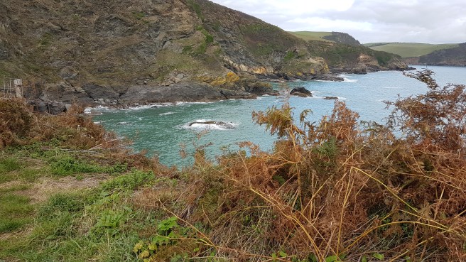
 and again some lovely turquoise colours in the sea…..maybe a result of the china clay residue which has filled this Bay for hundreds of years!
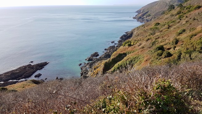 You know when Polperro is just round the corner when you see that some people are using other means of transport than feet…..
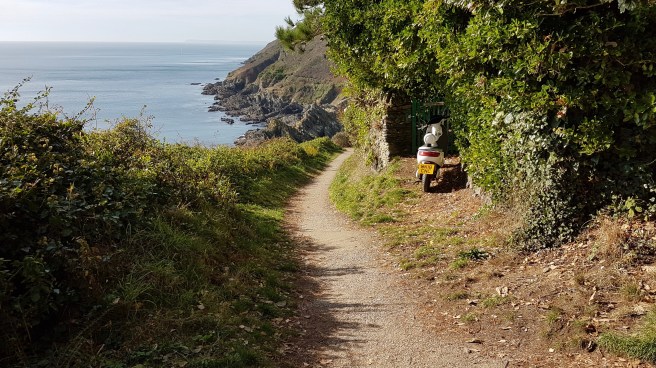
 The beach was fairly busy, as was the town (half-term). But in truth it is not a particularly nice beach (sorry Polperro).
 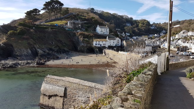 We saw one house that had four substantial flying buttresses holding it up – a feature which you only normally see on cathedrals, and here was the so-called ‘house-on-props’.
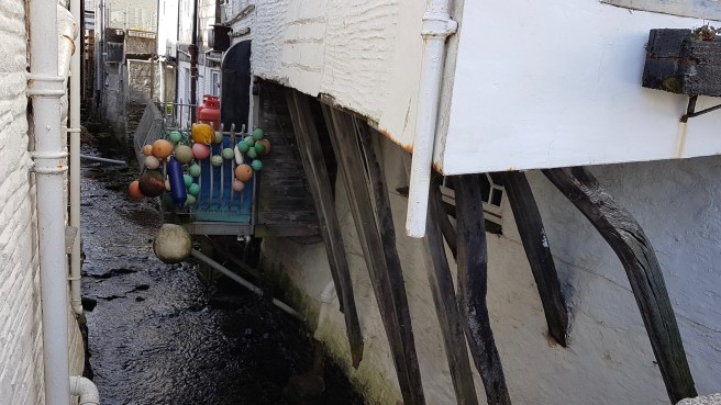 Really good there is a decent pub just by where you wait for the bus….
 And, as we had to change buses in Looe, we walked up to Looe beach which is very nice…
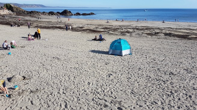 On the way home I took some moving shots just to show how green is my valley….virtually the whole way home you go along the river and are surrounded by trees…..

 and you have races sometimes (in my head anyway) with the train on the adjoining line which stops at Sandplace station only a handful of times ….. approx 30 passengers per week. We’ve never seen anyone waiting here…..
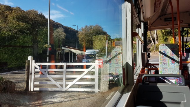
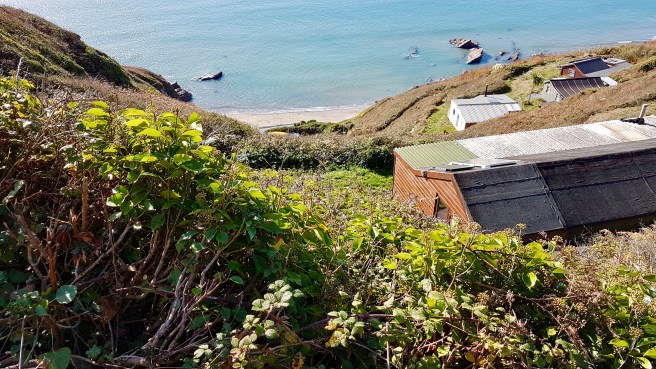
Chalet land…..
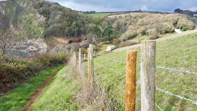
 The start of my walk today Tregantle fort is one of several forts surrounding Plymouth that were built as a result of a decision in Lord Palmerston’s premiership to deter the French from attacking naval bases on the Channel coast. It is still used by all 3 services today especially as a rifle range and when red flags fly a lot of the area is inaccessible. Luckily no flags today….
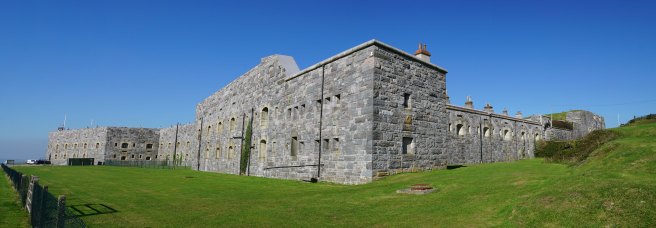
 We parked on the road by the side of the fort….it’s great that we are outside the tourist season as parking is eased all over Cornwall. We then walked down by the side of some of the ranges (later on we were to hear plenty of small-arms fire). An interesting notice for my collection…
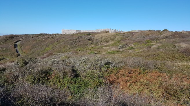
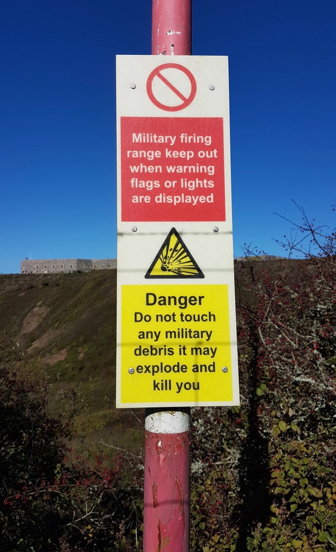 You can just see some of the targets in the pic below….here we are looking back towards Looe in the far distance.
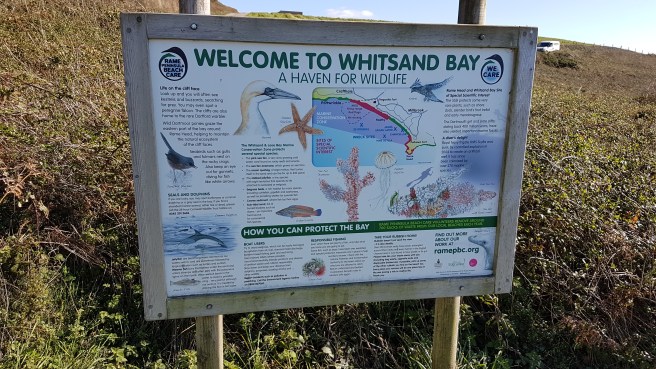
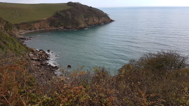
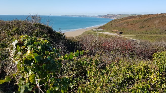 And it wasn’t long before we started to see the wonderful extent of Whitsand Bay which we have never visited, one of the longest stretches of sand in Cornwall, but difficult of access.
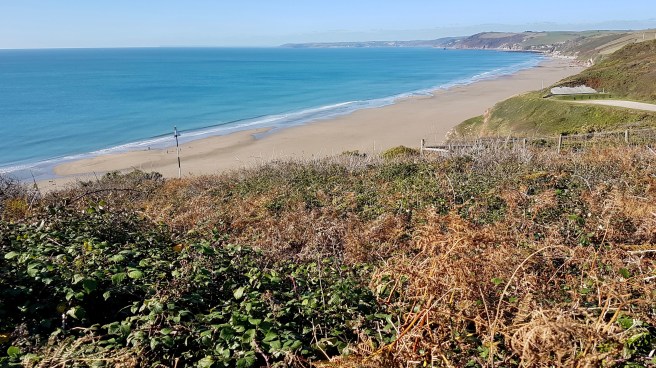 F. walked with me for a short while and we could just see ahead my objective – Rame Head. Throughout the walk it was extremely difficult to take pics of the way ahead as the sun was so dazzling (October in Cornwall!).
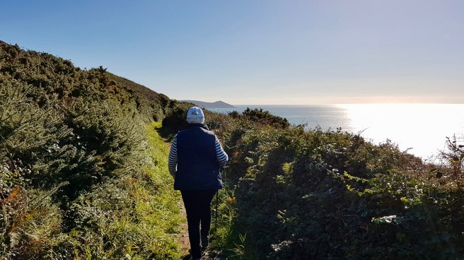 It was in between tides so at absolute low tide one can imagine how magnificent the beach looks.
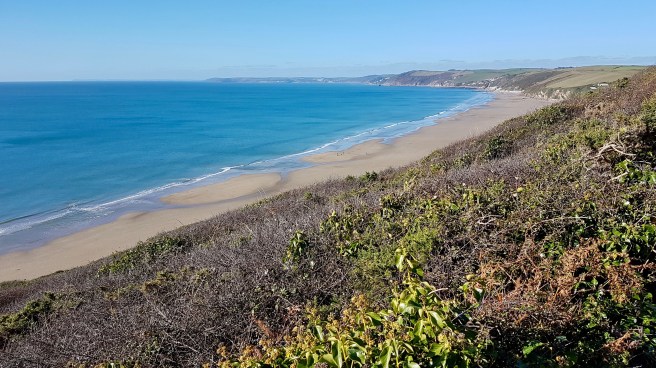
 F. turned around after a while and was due to meet me with the car somewhere on Rame Head…final destination open although I was hoping it would be the chapel on the end of the Head. Separate little coves soon started to appear, all accessible down very steep paths and indeed I met several groups of families in swimwear who were heading down to the beaches.
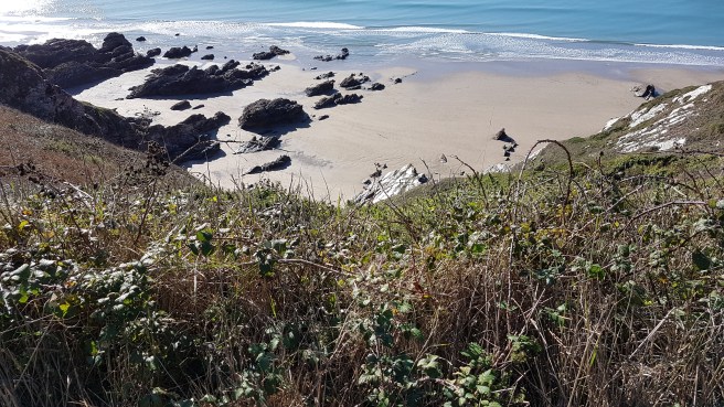 At one isolated spot a lookout appeared, and I assume this is one of the National Coastwatch Institution’s as there is one somewhere around here. Having visited two in the last couple of weeks I gave this one a miss.
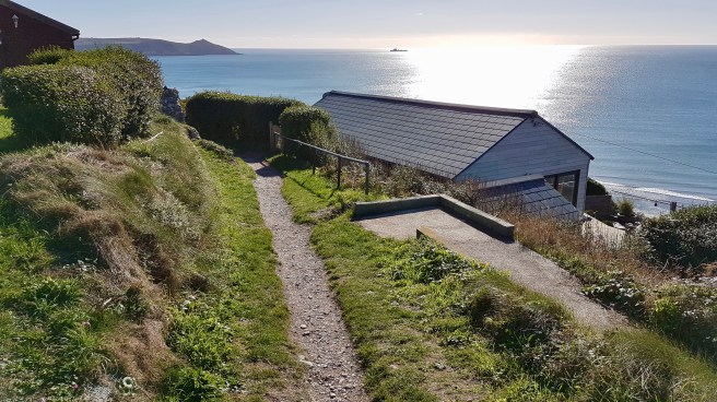
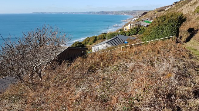
 All at once chalets appeared which seemed to cover the whole cliffside. What a lovely unspoilt walk this would be without them. Looks like a shanty town.
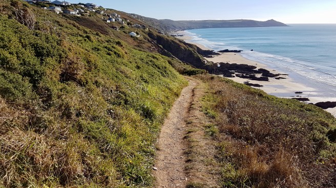 I assumed this walk would be quite flat. Wrong again, and I was glad F. had insisted I take my walking stick which is a tremendous help.
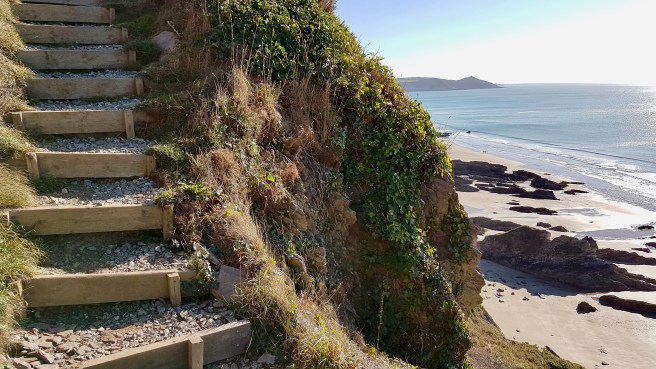 The path appears and disappears as you have to make your way through all the chalets (or huts)…..
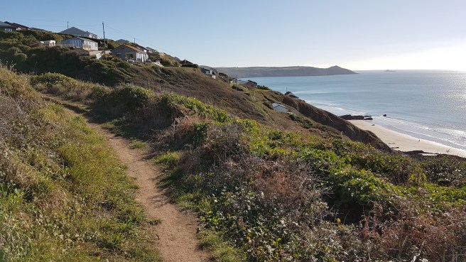
 Quite a few I noticed had Indian names, so I am assuming they were from the thirties or thereabouts…
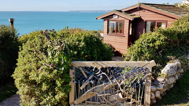
The thirties was a period before planning regulations, so the huts sprang up in a fashion that was at once anarchic and strictly governed by the landscape. As there were no natural ledges, families would dig out a bit of cliff and put the rubble at the front as a patch of garden. There was talk apparently, fairly recently, by the Council of knocking them all down. however what has happened is that they have just absolved themselves of all responsibilities and state that the whole cliffside is unprotected and they have no plans to manage erosion here. My own personal hope would be that in a thousand years erosion has tumbled them all into the sea. This bus stop has a fine view!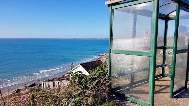 There are things blooming in Cornwall at all times of the year. Gorse is well-known to flower here all year round. This hedgerow was brightened up considerably. And I did see some wildlife!
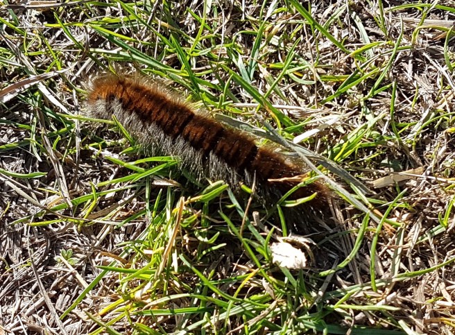
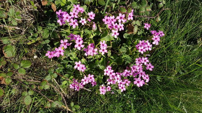
 Whilst the temptation is always to look seawards on a walk like this I did cross over the road (which you have to use occasionally) to get a great view in the distance of Plymouth.
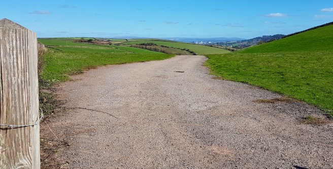 Of course there is danger wherever you go on the Cornish coast but this little monument was very poignant….
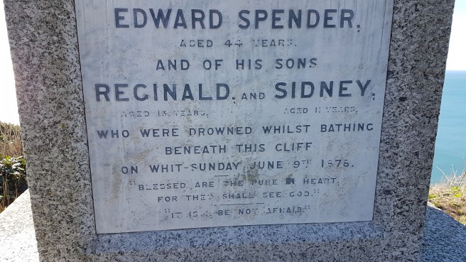
 I did see one restaurant with excellent views called rather unimaginatively ‘The View’. It had an exceptionally good-sounding menu. As an example I remember dabs for the first course and skate wing for the main with pancetta and gremolata. 2 courses for £14.50. Sounds great.
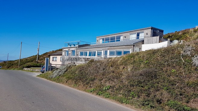
 I do like benches with a view and this was one of those walks where there were many.
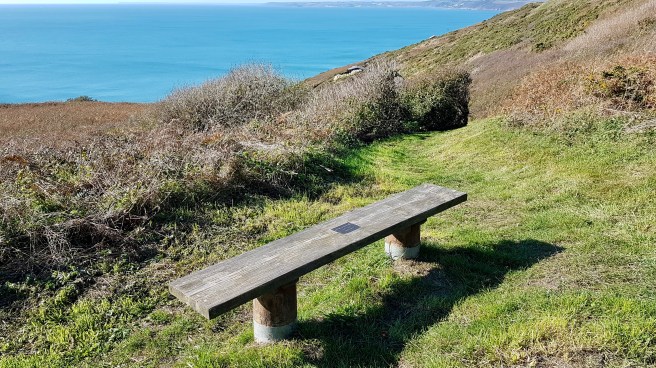 Nearing Rame Head the cliffs were still dangerous.
 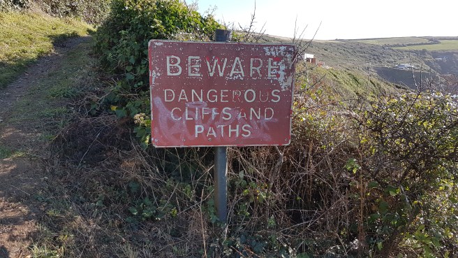 I could just see Polhawn Fort another one of the three along here. Polhawn Fort faces out over the beach and was built in the early 1860s to defend the eastern approach to Whitsand Bay. If was armed with a battery of seven 68-pounder guns. A design flaw was that its exposed left side could be attacked from the sea and this was not as heavily fortified as the front which faces onto the beach. Rather than improving it, its role was taken over by the batteries at Tregantle and Raleigh and Polhawn was abandoned by the MOD in 1928. The building survives in good condition as a hotel.
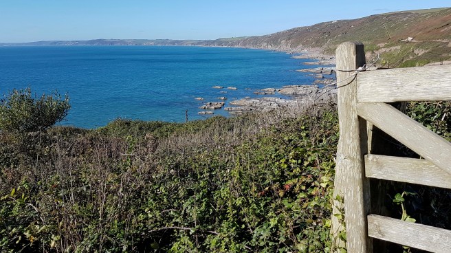 It was round about here with the Rame Head chapel just in reach that I received a message from F. saying she couldn’t get to Rame Head because the road was closed. I therefore decided to cut across the peninsula and meet her at Kingsand. My path led to the charming little hamlet of Trehill. It reminded me very much of a Lakeland village.
 As I dropped down into Kingsand I saw the third of the forts. Cawsand Fort was originally a Palmerston fort, and was remodelled as part of the late nineteenth-century defences that included the batteries at Pier Cellars and Penlee Point. Today it is a complex of luxury apartments. Good to see the variety of uses to which Palmerston’s forts have been put.
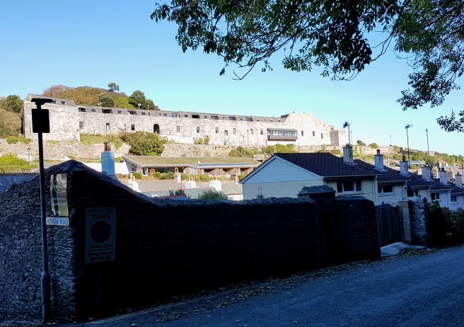 Perhaps you can just see a couple of bathers near the little beach at Cawsand – it was warm!
 As I have said before Kingsand and Cawsand together are one of the most delightful spots in Cornwall, and we always discover some new angle….
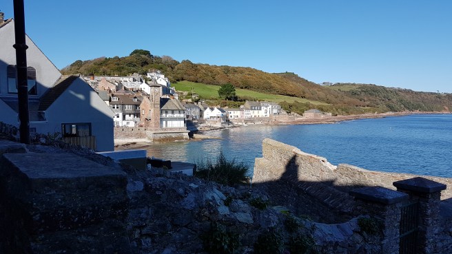
 Pity the houses are so expensive……..
This was the land of my content…….A walk towards Mevagissy
 A beautiful October day again saw us drive to Trenarren the end-point of my last walk. My destination from here this time was Pentewan which we had never visited. F. drove there after a short stroll with me on the first bit of my walk. I optimistically thought I would see her in an hour. It was more like three. Such are the vagaries of the Coast Path.
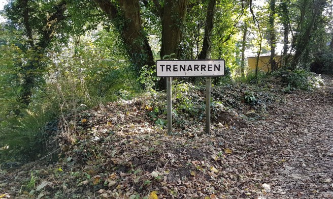
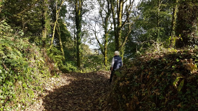 Very wooded to start off, it was interesting to note some private accesses to the Coast Path (must be nice).
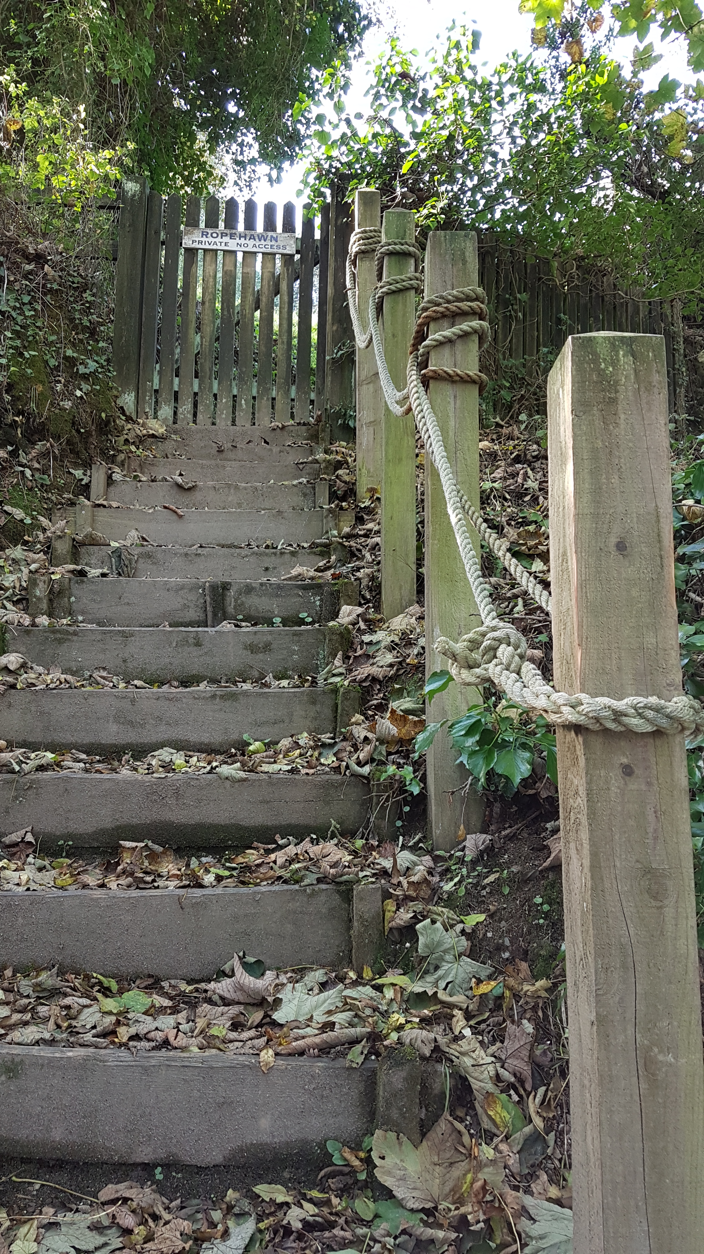 The view back was towards St Austell (mining country still) but the whole bay could be seen at times.
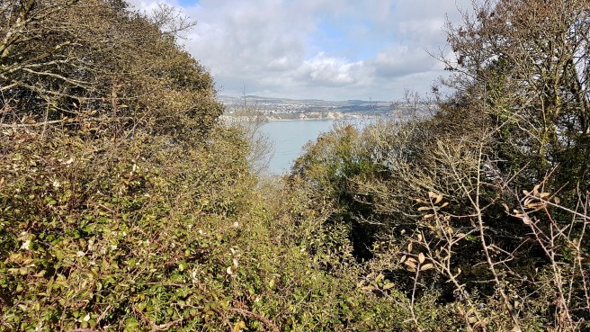 In places the sea was the beautiful turquoise colour which you find in photos of more exotic places….
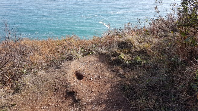 I soon saw ahead my first objective – the little promontory of Black Head. I found the engraved stone at the neck….This granite memorial engraved with “This was the land of my content”, was erected in the memory of Arthur Leslie Rowse, a Cornish writer and historian. Rowse was born in 1903, the son of an uneducated china clay worker, and was the first Cornishman to win a university scholarship, reading English at Christchurch College, Oxford. Rowse published about 100 books. By the mid-20th century, he was a celebrated author and much-travelled lecturer, especially in the United States. He also published many popular articles in newspapers and magazines in Great Britain and the United States. His brilliance was widely recognised. His knack for the sensational, as well as his academic boldness (which some considered to be irresponsible carelessness), sustained his reputation. His opinions on rival popular historians, such as Hugh Trevor-Roper and A. J. P. Taylor, were expressed sometimes in very strident terms. All three were well-known to me when I studied History at Oxford in the late Sixties……..And in fact Rowse retired to Trenarren House. I enjoyed learning all this.
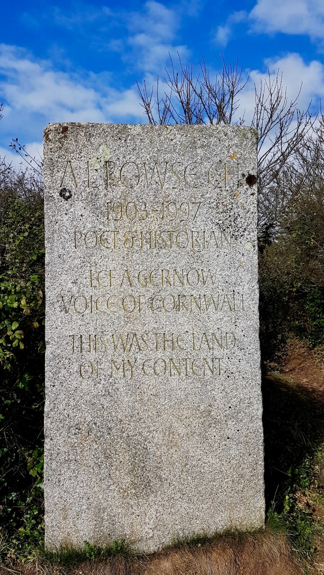
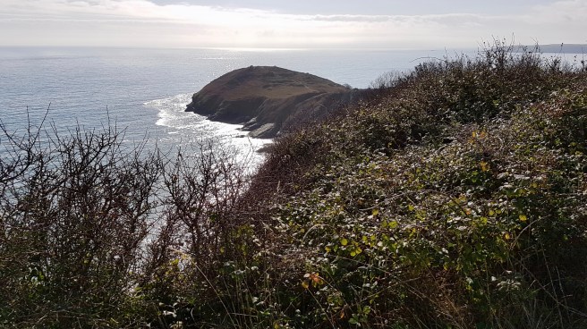 Great views of the bay and unsurprisingly there is a stone-age fort at the head. I thought I could discern some of the outline of ditches……


 Walking back along the promontory I discovered what I assume is a First or Second World War gun emplacement….
 Moving on steeply down, after leaving Black Head, I could see the isolated little hamlet of Hallane with two or three houses or cottages strung down the combe ending up at a rocky cove. Ideal for smugglers.
 The problem was that each building had carefully marked off grounds with the sort of ‘Strictly Private’ notices some folk love to put up. Failing to discern the correct route for the Coast Path I nearly ended up back at Trenarren, before consulting the OS map on my mobile. You would think that on a coastal path you may not need a map at all. Just keep the sea to your left! But it certainly doesn’t always work out like that.
 Presumably horses can get tired with the gradients round here too!
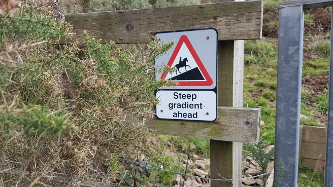 The correct route took me off into a wood along a pretty little brook on a stretch of land called The Vans (derivation?).
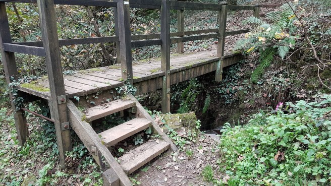 Next one of the brutal sections with very steep ascents and descents via steps, of which this shows just a small part. One can only laud the people who keep these footpaths in repair, but when you are using them you despair that they seem designed to be as difficult as possible, being half a step too long or too short between each riser…just the wrong amount especially for someone with bad knees like me.
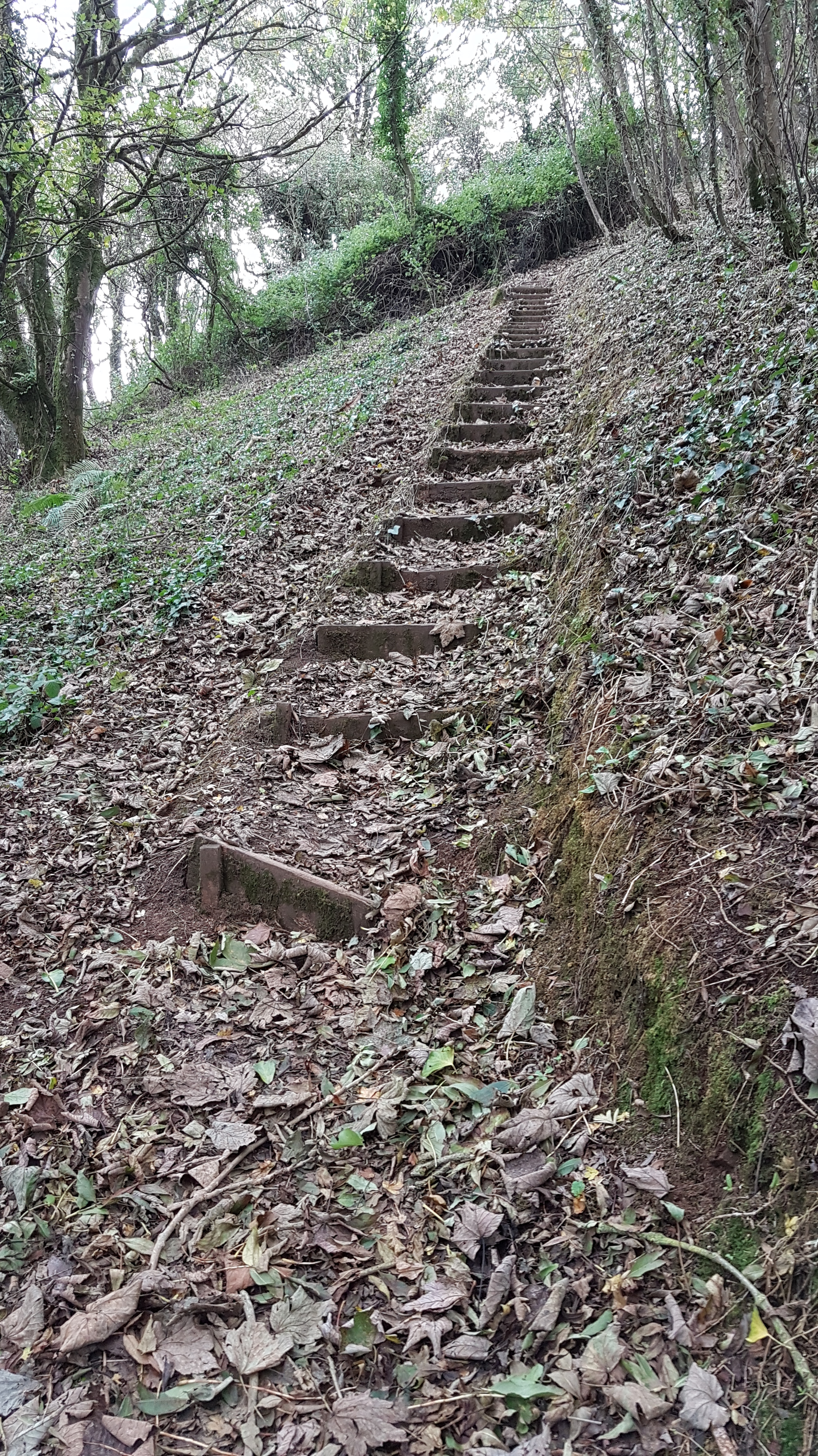
 Another individually designed bridge,,,
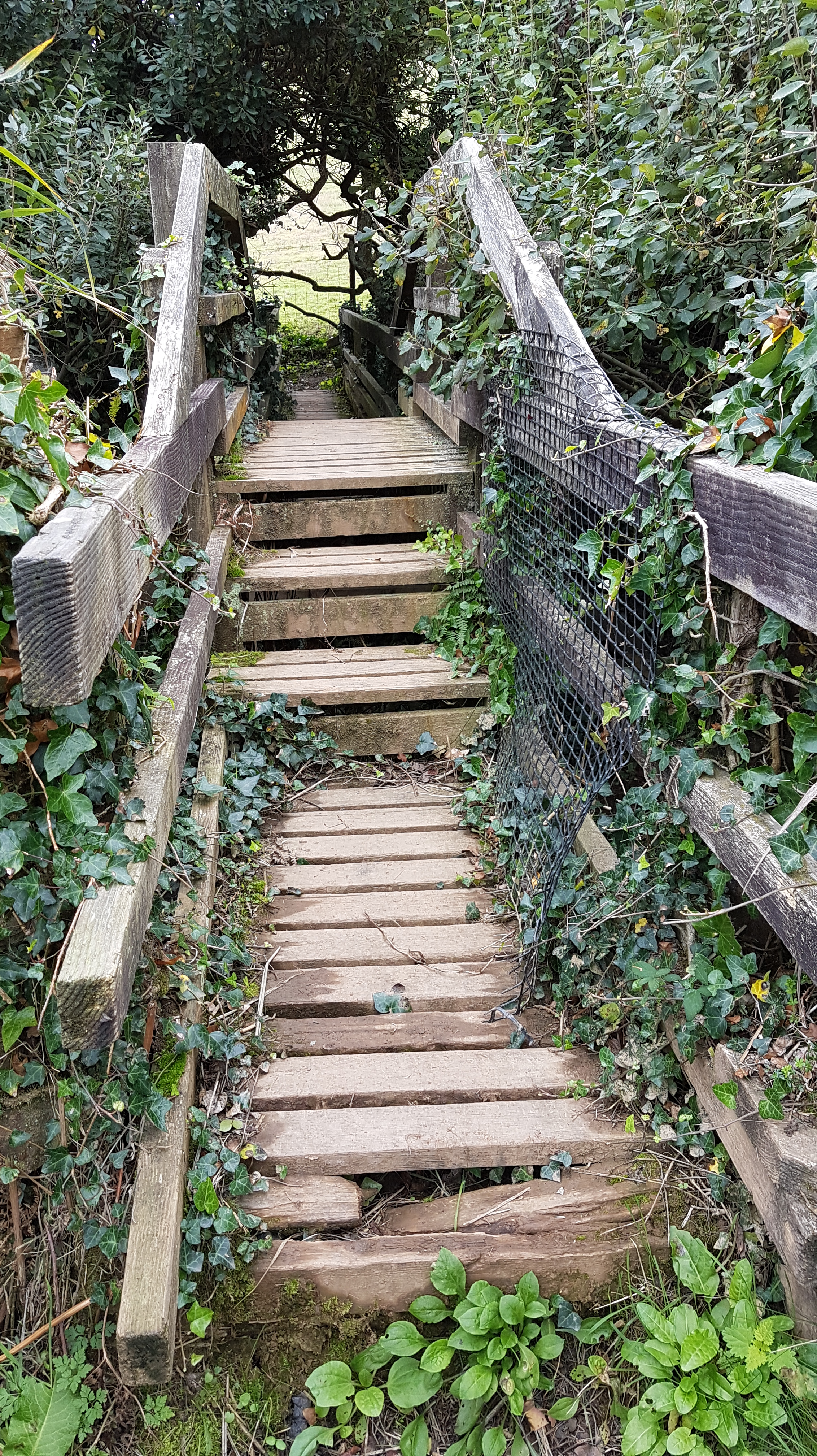 Good views of isolated little coves with no apparent access. Let’s hope the bamboo doesn’t become as much as a problem as in our garden. I do think Cornwall is in real danger of being suffocated by bamboo.
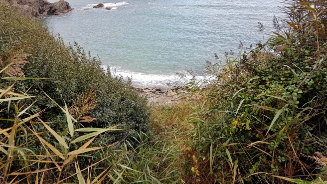
 What I had estimated and told F. in the beginning was starting to look silly now. What looks a short distance on the map, if full of these ups and downs can take 2 or 3 times as long as you think…..very dispiriting too to see them ahead of you, and to know from experience that what goes up must come down!
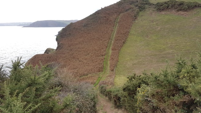
 Looking back at this point I could just about discern the red and white stripes of the distant Gribbin Head marker as well as Black Head itself.
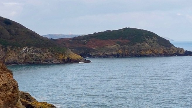

 And since I have no head at all for heights I must mention that parts of this section of the Coast Path do seem very exposed with steep drops inches away from the path….
 At last my destination of Pentewan Sands can be glimpsed..
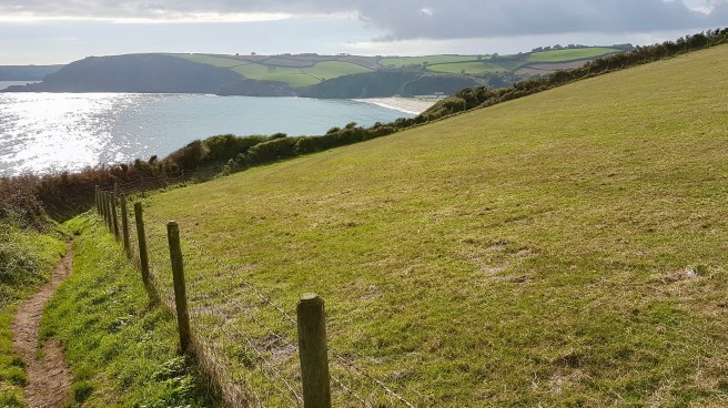
 But as it gets nearer the whole view and all sense of rural idyll is spoilt by the horrendous mobile home park typical of much else that totally spoils Cornwall. How could any sensible Planning Department give permission for all of this – plus deem the beach private to the Park. It’s an absolute disgrace. Cornwall really could be the place of your dreams or The Land Of My Content. But it isn’t. It’s despoiled and ravaged by caravan parks, mobile homes, wind farms, scruffy towns, no seeming overall plan, and the fact that it is is the end outcome of profit and cost control versus the environment.
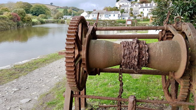
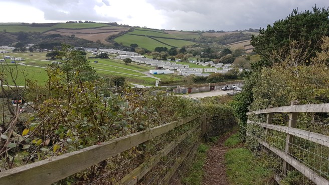 As I move down the last hill (thank God) into Pentewan itself it is revealed as a quite charming village hunkered over its own bit of inland water and with some well-preserved remains of its previous industrial past. The always excellent Iwalkcornwall site has this to say…..”Pentewan dates back to mediaeval times when it was mainly a fishing village with a harbour. The harbour was rebuilt in the 1820s both for the pilchard fishery and to create a china clay port. At its peak, a third of Cornwall’s china clay was shipped from Pentewan. However the harbour had continual silting problems which meant that it was eventually overtaken by Charlestown and Par. As well as longshore drift carrying sand east across Mevagissey Bay, there was also silt being washed down the river from china clay works and tin streaming. Consequently, the harbour gradually silted up with the last trading ship leaving in 1940 and World War II literally sealing its fate. By the 1960s, the harbour was only accessible to small boats and today the harbour basin is entirely cut off from the sea………… names of many coastal features are derived from words in the Cornish language:
- Pen – Headland (Cornish for “top” or “head”)
- Pol – often used to mean Harbour (literally “Pool”)
- Porth – Port but often used to mean Cove
- Zawn – sea inlet (from the Cornish “sawan” meaning chasm)
Note that Haven has Saxon origins (hæfen in Old English) which is why it tends to occur more in North East Cornwall (Millook, Crackington, Bude etc)……..
 In fact the more I see of Pentewan the more charming it becomes. And, meeting Frances, we wander off to the local pub the Ship which is very presentable indeed…….
 …. and as well as bars and beer garden has a library. Who would have thought it?
 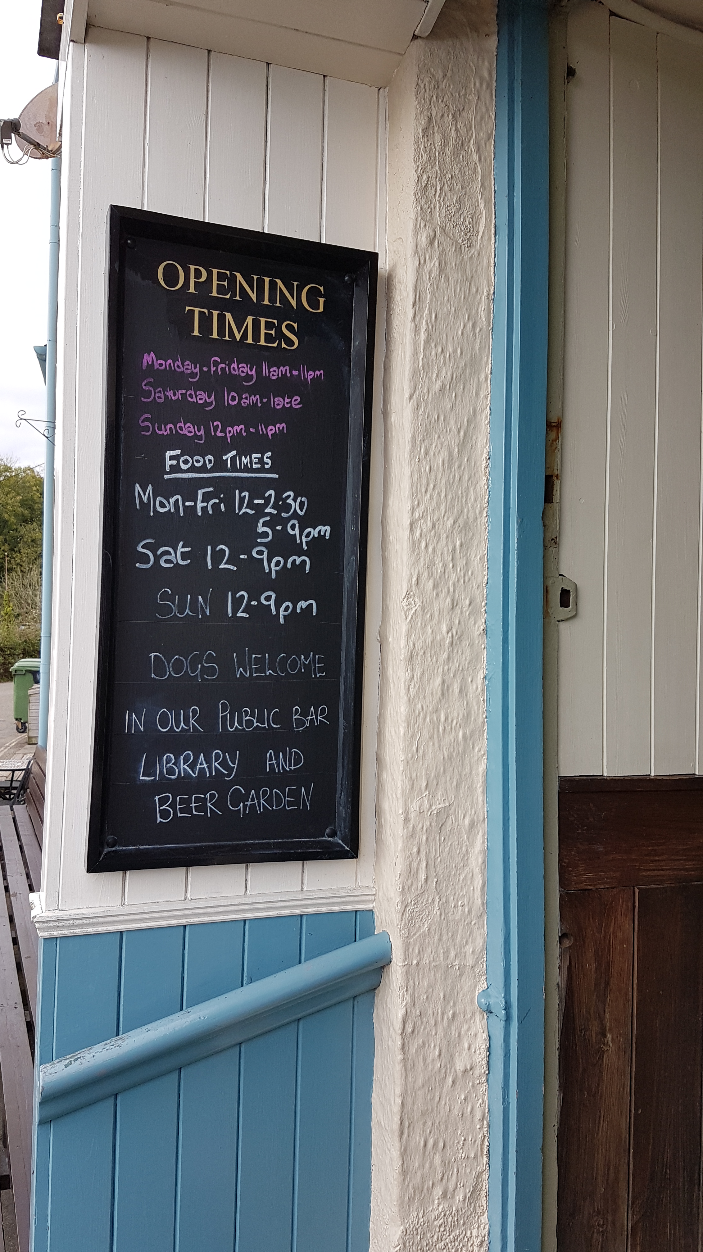 And a sense of humour of sorts…
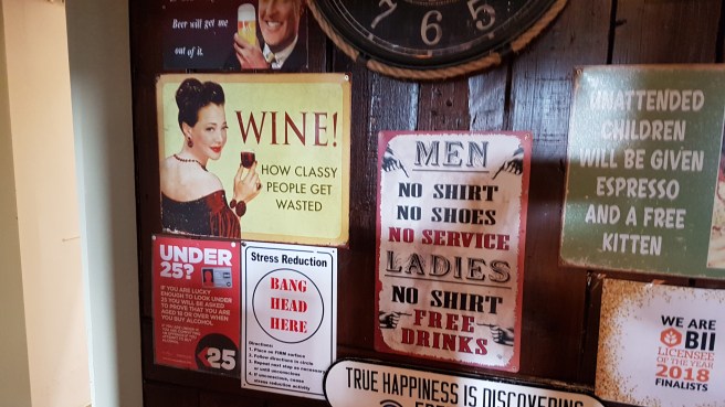 We sit on benches outside enjoying the afternoon warmth and in front of us is a ‘Gin and Sorbet’ bar which would make London Metropolitans jealous. As it says with humour a bit like my own….’Let The Good Times BeGin’. Well, well.
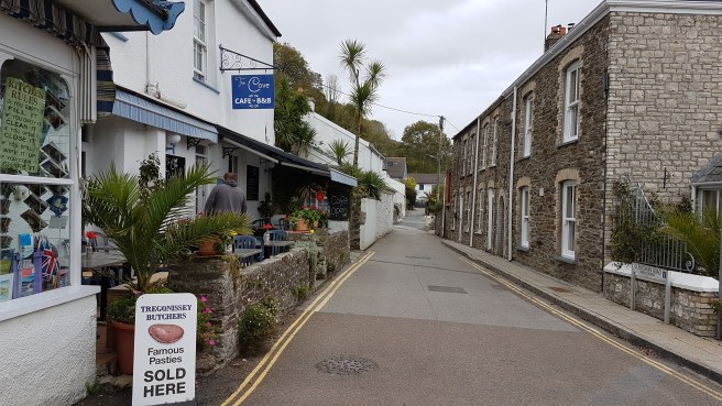
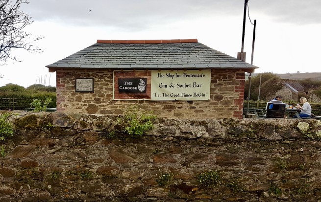 Walking to the car we pass through the heart of the village….
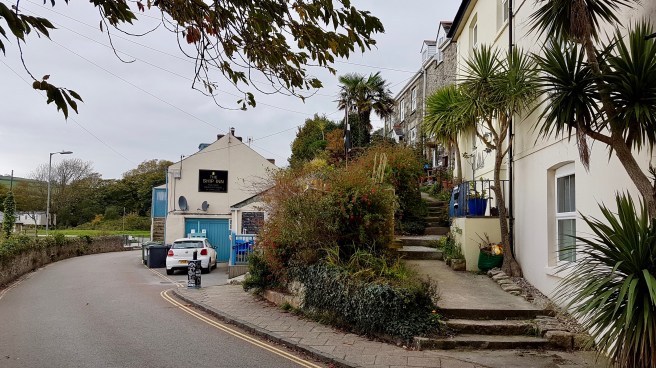 ….which even has a village green of the sort you might expect in Yorkshire or the Lake District……what a lovely place. How even more angry I am at the blot on earth that is the dominating mobile home park….and the concept of a ‘private’ beach….ugh.
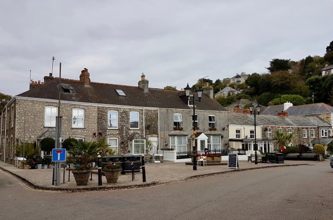
From Carlyon Bay to Trenarren….and surely some of the steepest bits of the SW Coast Path….27/9/18
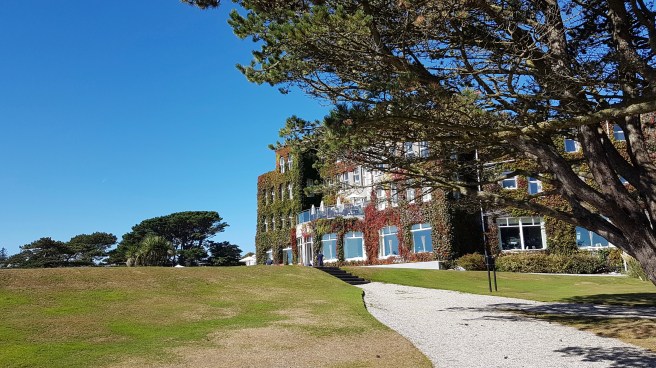 On another glorious September day off we went and parked up by the excellent Carlyon Bay Hotel. What a joy it is to do what we want (well within reason, and as long as it doesn’t cost too much) whenever we want. After using the hotel’s facilities (very nice), we admired the view of the bay from the grounds…….
 and then set off passing some very nice new flats (starting at half a million), and being dazzled by the reflections on the sea……..
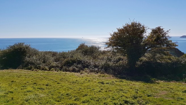 We then came across a watch tower which was evidently manned. On closer inspection there was a notice saying ‘Visitors Welcome’ which I was very surprised to see, and so up the steps we went to a very warm welcome.
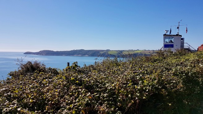 The watchtower – Charlestown Station – is indeed an old coastguard station. Many will know of the concerns when in an economy drive they were nearly all shut. In fact in 1974 there were still 127 stations (permanently manned) and 245 auxiliary stations. Now there are just 10 Coastguard Operations Centers (CGOCs) and one National Maritime Operations Centre (NMOC). Local concern all around the country about the loss of local visual watch and local knowledge led to the setting up of volunteer-run watch stations and the establishing of the National Coastwatch Institution (NCI). This watchtower is an NCI station. Built in the early twentieth century as an auxiliary Coastguard lookout, it became redundant in the cuts and was abandoned . Rediscovered and resurrected from its derelict state in 2001 it was re-opened after extensive work in 2003.
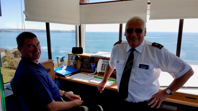 Regarding its purpose, as our hosts noted…….”Whilst high technology and sophisticated systems are aids to improved safety, a computer can’t spot a distress flare, an overturned boat or a yachtsman or fisherman in trouble. Other vulnerable activities like diving, wind surfing and canoeing are made safer with visual surveillance.” It operates 365 days a year and provides visual watch over all users of St Austell Bay. The leaflet we got informs us that ‘NCI watchkeepers provide the eyes and ears along the coast, monitoring radio channels and providing a listening watch in poor visibility. They are trained to deal with emergencies, offering a variety of skills and experience and full training by the NCI ensures that high standards are met. Over 246,000 hours of organised coastal surveillance were completed in 2016 alone, all at no cost to the public. Funding is managed by a Board of Trustees.’ The Charlestown Station itself is sponsored by the Carlyon Bay Hotel amongst others, and relies like all the others totally on contributions. We donated £5, a small amount indeed but very gratefully received. The UK has a world-wide reputation for its charity work and volunteer giving. A total amount of £9.7 billion was donated by generous Brits in 2016. However it is salutary to note that whilst the UK is Europe’s most generous country it still lags behind the developing world, especially Africa. Indeed only six of the G20 largest economies in the world feature in this year’s top 20. Interesting. Just after this worthwhile diversion we saw these two seats placed so that you could look forwards or back! They perhaps represent what walking on the SW Coast Path is all about, and I never fail to look where I have been as well as where I am going……
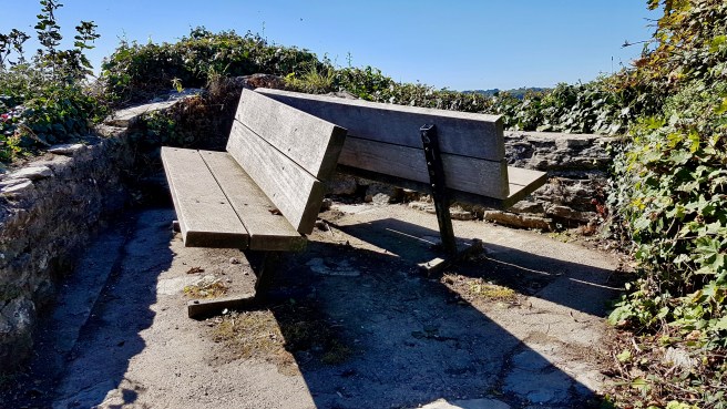 Proceeding, we soon had our first glimpse of Charlestown Harbour (where Poldark is filmed of course)…..
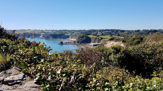 and we dropped down towards it…..
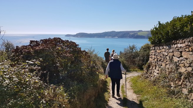
 passing some beautiful cottages (a lot let out to rent, of course, as everywhere in Cornwall)….
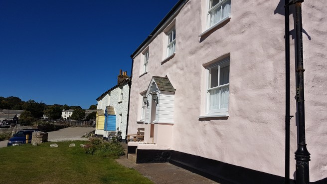 and we then hit the first objective (you’ve always got to have objectives)…the Pier House Hotel and Pub….
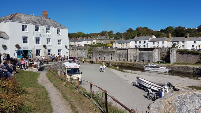
 Thirst slaked, we parted…..F. to return the way we had come and me to push on to be met by her later. There was a steep climb out of the village…..
 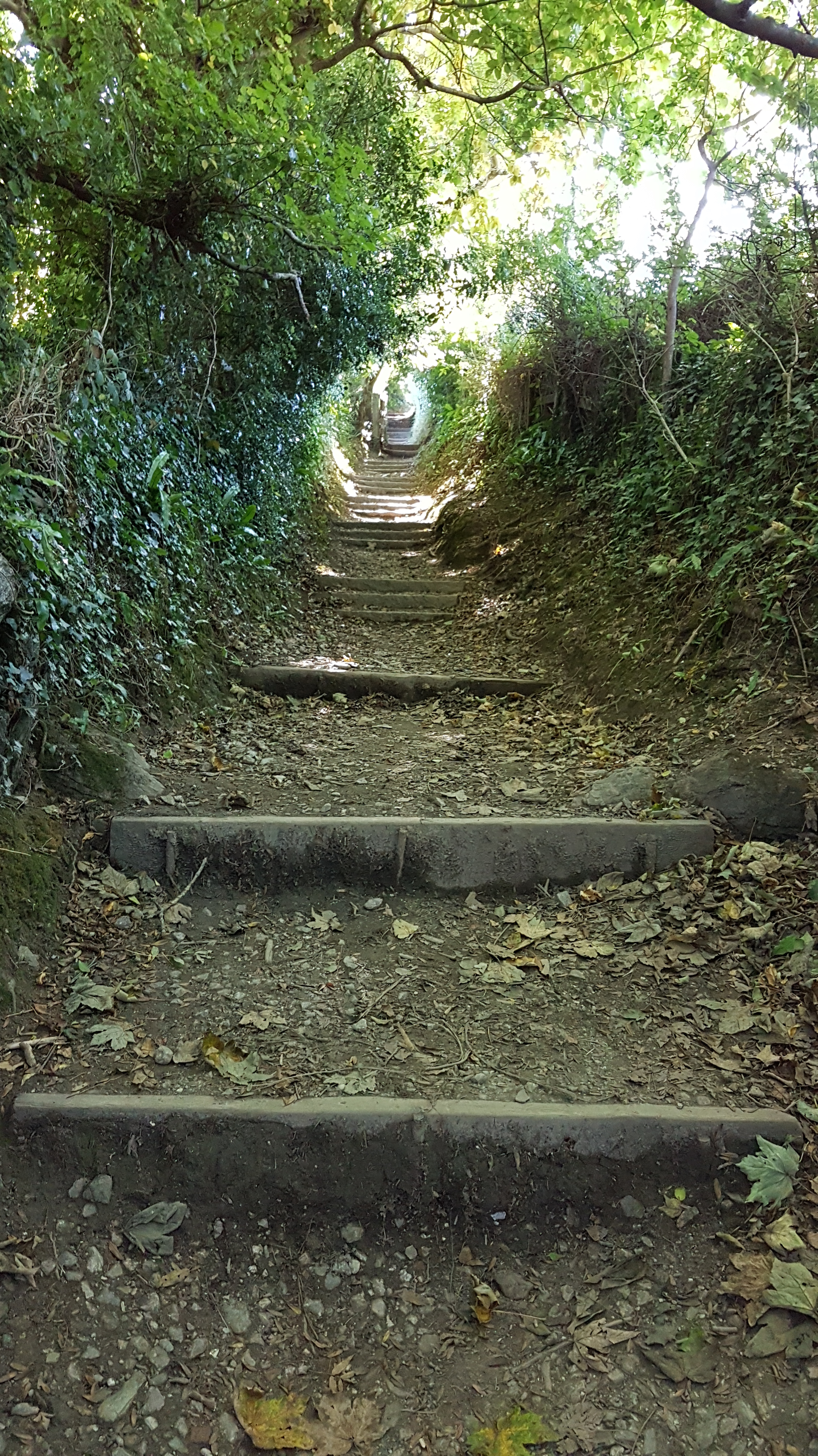 and an old kissing gate…..
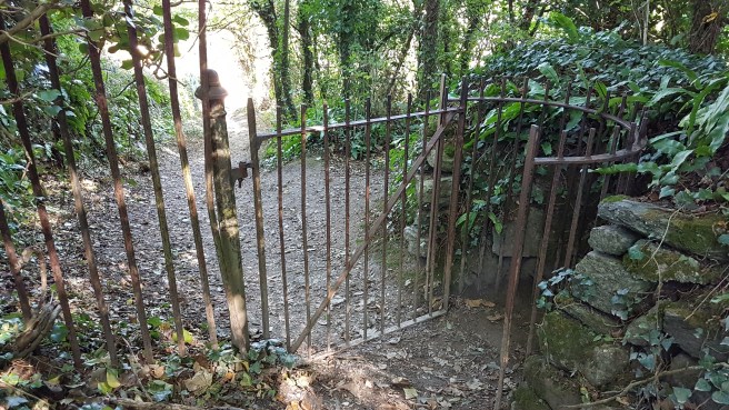 ……before coming to another point of interest on this walk….
 Next a view along Porthpean beach…….
 I then came across a derelict tower (perhaps a Second World War watchtower?) to which I gained access…
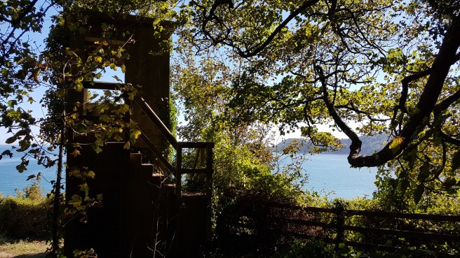 and the views – both ways of course – were worth it….
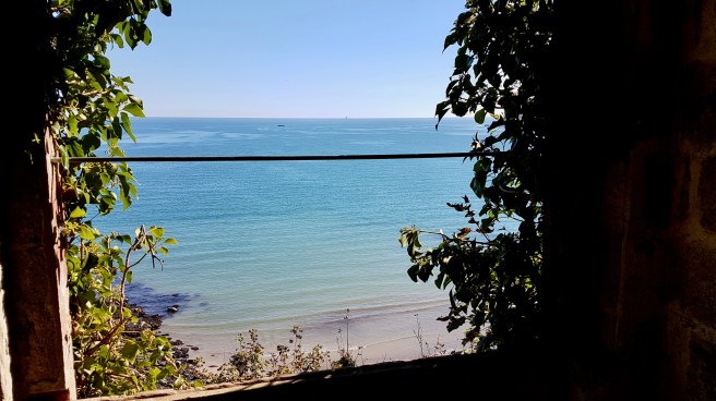
 Approaching the beach itself all was peace and solitude……with about three couples enjoying the sun
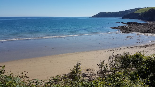
 I do love coming across weather-beaten wood of all kinds…they’d pay a fortune for this ‘Porthpean look’ in some expensive houses…
 and I loved this little antique jug which was tied to a post…perhaps water for dogs left by some kind soul, who knows? If it had been Rose wine…….
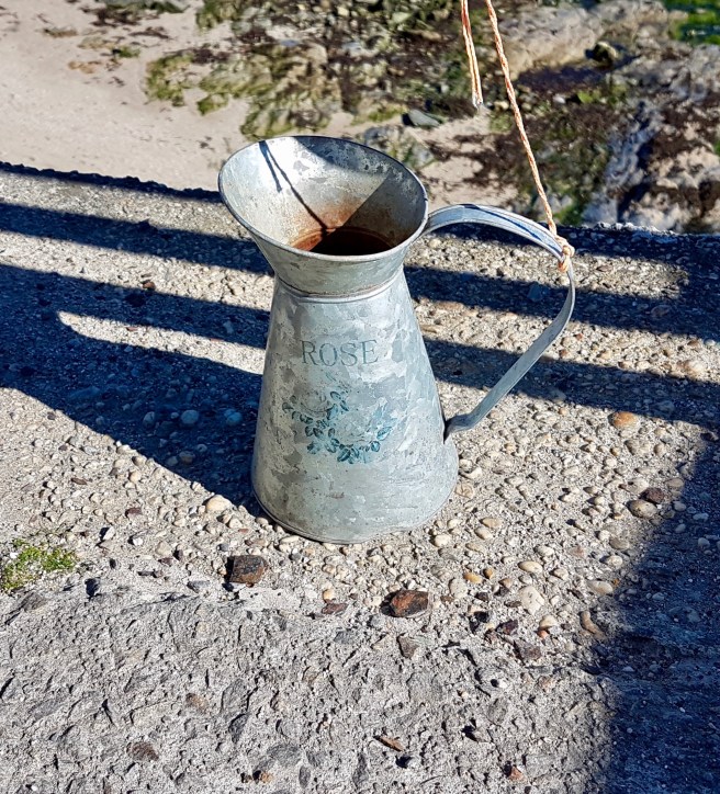 Porthpean seems a good sort of place with a tiny village on the hill and an energetic boat club…
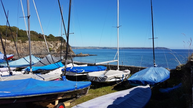 The hedge adjacent to the clubhouse was all wild fuschias…of which I see many on my walks on the Path…..
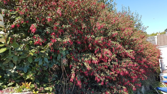 After admiring the scene before me for a while longer…..
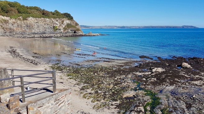 ….I met up with F. but decided to push on a little further…..
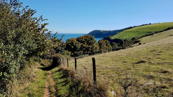 loving the colours on the sea….
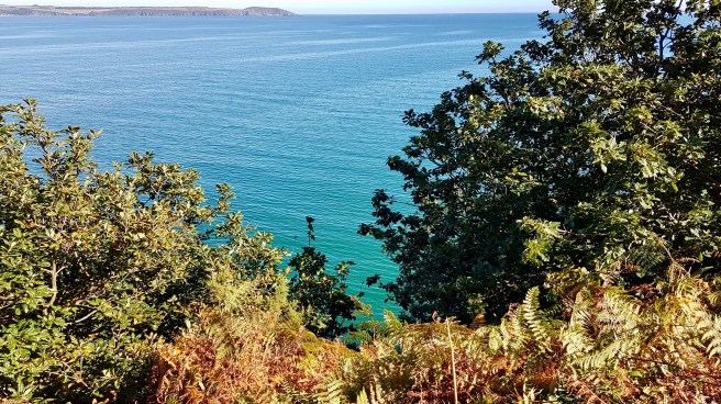 I then came across what I call a see-saw stile. …..never seen anything like it…I’m sure it’s not meant to be like this – but it was quite good fun. I don’t know whether I have mentioned before but I am fascinated by all the varieties of stile and kissing gate and fencing and walling and so on there are around the country, some regional types, some NT Head Office inspired, some quirky builds of seemingly quirky minds. I am astonished that there is not a book in the amazing Shire Books series which covers just about everything else you can think of!
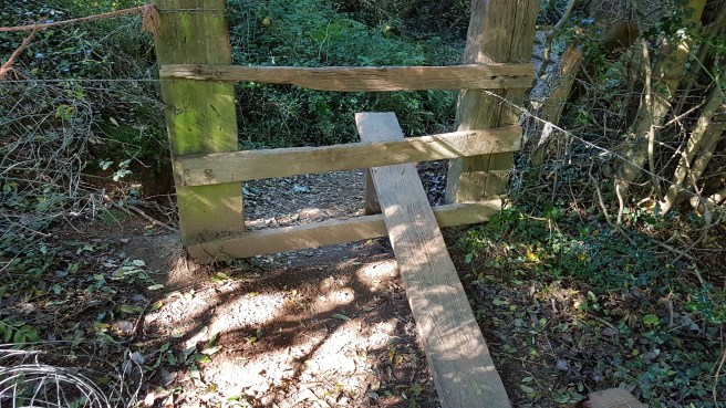 Ascending the next hill past a few animal friends…..
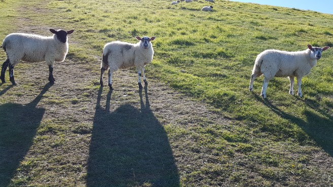
 I passed, in a little clearing, the remains possibly of an old Celtic cross…..
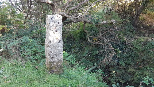 and looked down on the most beautiful little beach – to which there didn’t seem any access.
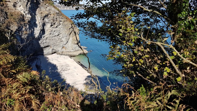 My SW Coast Path guide refers next to ‘steps’. Well what can I say? I have never ever experienced such a steep descent followed by an almost vertical ascent, both long. Not on the SW Path nor climbing Bowfell or Scafell Pike or anywhere else. This pic gives a little idea…..but only a little.
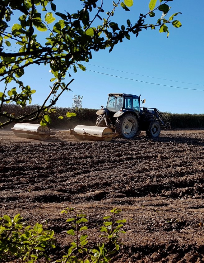
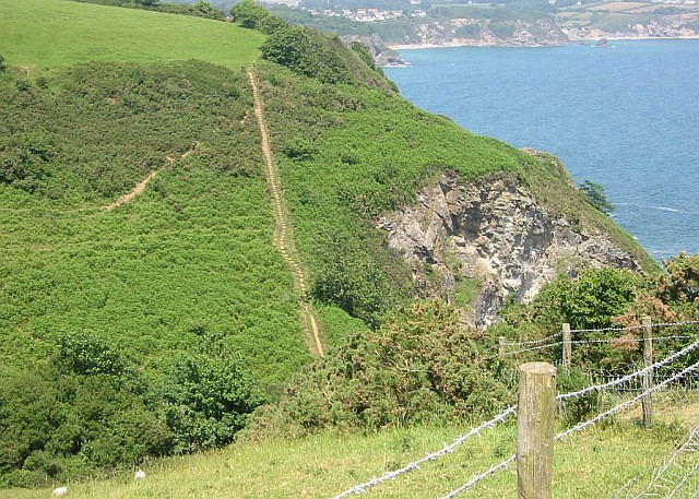 I was very glad to meet up with F. again at the remote little hamlet of Trenarren, and relax watching some gentle farming activity……